


Outer Green Bay City PUMA, Wisconsin
About
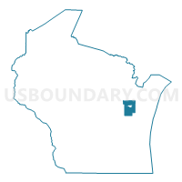
Outline

Summary
| Unique Area Identifier | 194398 |
| Name | Outer Green Bay City PUMA |
| State | Wisconsin |
| Area (square miles) | 559.31 |
| Land Area (square miles) | 483.62 |
| Water Area (square miles) | 75.69 |
| % of Land Area | 86.47 |
| % of Water Area | 13.53 |
| Latitude of the Internal Point | 44.47103030 |
| Longtitude of the Internal Point | -87.99359380 |
Maps

Graphs
Select a template below for downloading or customizing gragh for Outer Green Bay City PUMA, Wisconsin


Neighbors
Neighoring Public Use Microdata Area (by Name) Neighboring Public Use Microdata Area on the Map
- East Central Wisconsin PUMA, WI
- Fond du Lac & Calumet Counties PUMA, WI
- Green Bay City PUMA, WI
- Manitowoc & Kewaunee Counties PUMA, WI
- Marinette, Oconto, Door & Florence Counties PUMA, WI
- Outagamie County PUMA, WI
Top 10 Neighboring County (by Population) Neighboring County on the Map
- Brown County, WI (248,007)
- Outagamie County, WI (176,695)
- Manitowoc County, WI (81,442)
- Calumet County, WI (48,971)
- Shawano County, WI (41,949)
- Oconto County, WI (37,660)
- Door County, WI (27,785)
- Kewaunee County, WI (20,574)
Top 10 Neighboring County Subdivision (by Population) Neighboring County Subdivision on the Map
- Green Bay city, Brown County, WI (104,057)
- De Pere city, Brown County, WI (23,800)
- Howard village, Brown County, WI (17,399)
- Ashwaubenon village, Brown County, WI (16,963)
- Bellevue village, Brown County, WI (14,570)
- Allouez village, Brown County, WI (13,975)
- Suamico village, Brown County, WI (11,346)
- Buchanan town, Outagamie County, WI (6,755)
- Ledgeview town, Brown County, WI (6,555)
- Hobart village, Brown County, WI (6,182)
Top 10 Neighboring Place (by Population) Neighboring Place on the Map
- Green Bay city, WI (104,057)
- De Pere city, WI (23,800)
- Howard village, WI (17,399)
- Ashwaubenon village, WI (16,963)
- Bellevue village, WI (14,570)
- Allouez village, WI (13,975)
- Suamico village, WI (11,346)
- Hobart village, WI (6,182)
- Pulaski village, WI (3,539)
- Wrightstown village, WI (2,827)
Top 10 Neighboring Unified School District (by Population) Neighboring Unified School District on the Map
- Green Bay Area School District, WI (136,070)
- Howard-Suamico School District, WI (28,500)
- Kimberly Area School District, WI (26,118)
- Kaukauna Area School District, WI (22,458)
- De Pere Unified School District, WI (21,243)
- West De Pere School District, WI (20,396)
- Pulaski Community School District, WI (19,371)
- Ashwaubenon School District, WI (15,975)
- Seymour Community School District, WI (12,917)
- Luxemburg-Casco School District, WI (11,083)
Top 10 Neighboring State Legislative District Lower Chamber (by Population) Neighboring State Legislative District Lower Chamber on the Map
- Assembly District 3, WI (65,789)
- Assembly District 5, WI (61,133)
- Assembly District 2, WI (61,009)
- Assembly District 89, WI (58,999)
- Assembly District 88, WI (58,089)
- Assembly District 90, WI (56,344)
- Assembly District 6, WI (55,963)
- Assembly District 4, WI (54,953)
- Assembly District 1, WI (54,189)
Top 10 Neighboring State Legislative District Upper Chamber (by Population) Neighboring State Legislative District Upper Chamber on the Map
- State Senate District 1, WI (180,989)
- State Senate District 30, WI (173,432)
- State Senate District 2, WI (172,047)
Top 10 Neighboring 111th Congressional District (by Population) Neighboring 111th Congressional District on the Map
Top 10 Neighboring Census Tract (by Population) Neighboring Census Tract on the Map
- Census Tract 9400.01, Brown County, WI (14,585)
- Census Tract 1013, Oconto County, WI (8,785)
- Census Tract 9604, Kewaunee County, WI (8,589)
- Census Tract 207.04, Brown County, WI (7,710)
- Census Tract 205.03, Brown County, WI (7,705)
- Census Tract 214, Brown County, WI (7,038)
- Census Tract 207.03, Brown County, WI (6,963)
- Census Tract 103, Brown County, WI (6,892)
- Census Tract 133, Outagamie County, WI (6,551)
- Census Tract 16, Brown County, WI (6,505)
Top 10 Neighboring 5-Digit ZIP Code Tabulation Area (by Population) Neighboring 5-Digit ZIP Code Tabulation Area on the Map
- 54115, WI (41,178)
- 54313, WI (35,897)
- 54311, WI (33,580)
- 54302, WI (30,611)
- 54304, WI (28,153)
- 54303, WI (27,041)
- 54130, WI (25,108)
- 54301, WI (22,742)
- 54162, WI (9,065)
- 54165, WI (7,539)